
Where in the world is Pitts Landing? A Story Tour!
Author: Stewart Hall, Virginia Certified Ecotour Guide
It’s a fair question. A lot of people who live within a thirty-minute drive of the place wouldn’t be able to answer it. But many first-time visitors, who either sought out the place for its remoteness or (more likely) just plain got lost, are amazed at its beauty. The Eastern Shore is known for its saltwater environments, and there’s plenty of that if you head west from the landing and out into Pocomoke Sound and the Chesapeake Bay, but you’ve got a brackish water ecosystem right at your feet at the landing and freshwater habitats just a short paddle away if you head up Pitts Creek to the east. You could say it’s got it all!
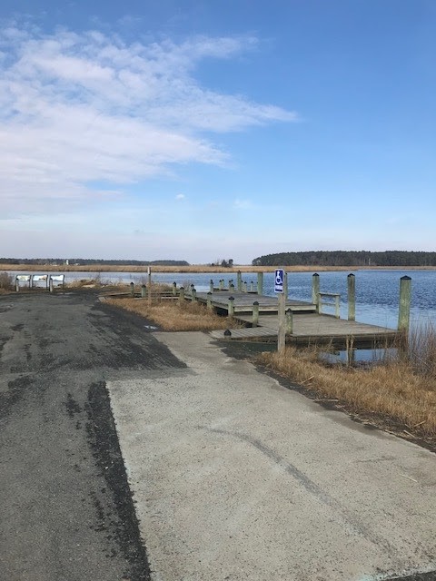
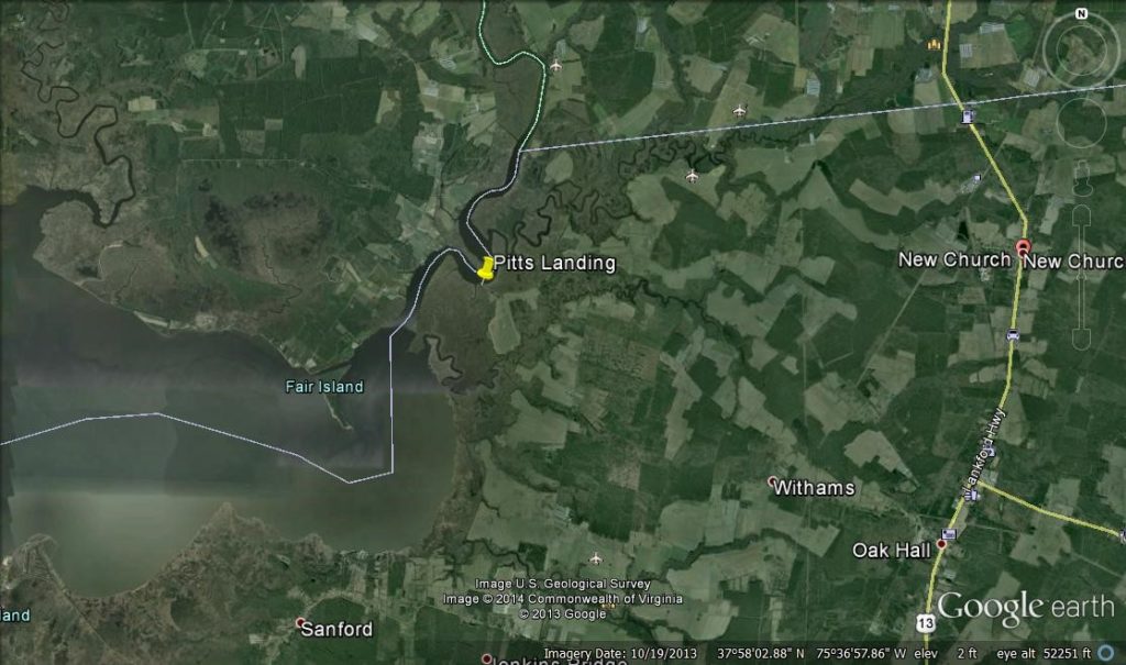
So where exactly is Pitts Landing? Well it’s located in the extreme northwestern corner of Accomack County on the Eastern Shore of Virginia. The landing is on the Pocomoke River but the entrance to Pitts Creek is within sight (when at the landing, look to the northeast for the stand of trees that is located at the creek mouth) . The center of the river, just off the boat ramp, is actually the Virginia-Maryland state line, separating Accomack County, Virginia from Somerset County, Maryland. There are a handful of homes on the road leading to the landing but the closest settlement of any size is New Church, Virginia to the east. If you are standing at the landing and looking across the river and just slightly west, you’ll see a small village. It’s Shelltown, Maryland, which is just a short paddle across the water, but 25 miles and 41 minutes away by car! (Source: Mapquest).
There has been a landing at this location for many, many years. In fact, the famous Captain John Smith travelled through here in search of drinking water while he was exploring the Chesapeake region (Source: Interpretive Display by National Park Service). In 2015, the National Park Service partnered with Accomack County and adjacent landowners to place this location on the Captain John Smith Chesapeake National Historic Trail, construct a soft launch for paddle craft, install an interpretive display, and make other improvements to the facility. Check out the display for some cool history about the site and to find out what Captain Smith thought about drinking the water here. There’s also a neat picture of the steamboat wharf that was active in the 1800’s. At low tide, some of the old pilings can still be seen along the bank in the little cove just to the left of the display.
So how did this place get its name? It goes back to the Pitt family. Mr. Robert Pitt, IV was a prominent businessman who owned the plantation house that was on your left before you made the last right turn to head down to the landing (Source: Virginia Dept. of Historic Resources https://www.dhr.virginia.gov/historic-registers/001-0038/) . The house and property was later owned by Mr. Harry Bell (you may have noticed that Bell Road leads to the landing). The Williams family, descendants of Mr. Bell, still own the property. And if you’re lucky you might run into one of them at the landing and get the opportunity to learn much more about the history of the area.
So let’s shove off and get out on the water! With binoculars and fishing poles at the ready we head out to the salty water of Pocomoke Sound and anchor up on an oyster rock off Saxis Island called, appropriately, Old Shell Rock. It’s early October, the opening day of the Fall Striped Bass (a.k.a. Rockfish) and a great time of year to be in the outdoors. We’ll keep our eyes peeled for birds, big white gannets in particular, and hope to find a flock of them in a frenzy over a school of feeding rockfish, picking up the scraps that rise to the surface. If we can’t find any birds, we’ll anchor up and try some bottom-fishing with the last of our peeler crab bait or maybe do some light tackle jigging. As we’re working the jigs we’ll watch the cormorants that are working the area for their meals and starting to bunch up for Fall. It’s early yet for migratory waterfowl but we might get lucky and see the first arrivals of surf scoter and marvel at how long they can hold their breath underwater. What are the scoters doing under there anyway? Likely picking up some tasty mussels off the same shellpile that we’re fishing for our meal.
If the wind picks up or the fish are uncooperative, we’ll head back to the sheltered water of the river, run just past Pitts Landing, and go to the mouth of Pitts Creek. We’ll cut the throttle and motor up very slowly, letting everyone pull out their binoculars and smart phones for the one or more eagles that seem to always be perched in the pine trees there, as if protecting the creek from intruders. Here we’ll do some casting toward the shorelines with soft plastic lures and Rattletraps. The guests that are tired of casting will watch the muskrats that are swimming around us and maybe get to see a river otter pop its head up like a periscope or play on the bank before disappearing in the Phragmites.
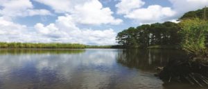
Once everyone has had their fill of fishing, we’ll start doing some hard-core exploring. We’ll wind through the twists and turns of the creek and watch as the ecosystem turns from brackish to fresh. After coming around one turn we’ll cut the motor and take a few minutes to soak in the awesome view in the photo below.
 For the turtle lovers on the boat, we’ll drift past some logs that are extending into the creek. We’ll try to figure out just how many turtles can fit on one log and laugh when they all decide to evacuate at the same time and go “plick-up” into the shallow water. In this area someone might spot a strange looking freshwater fish with a long, pointed nose. It’s a longnose gar, common in these waters but rather uncommon in the creeks south of here due to their higher salinity. Just how big can those fish get? Well, in 2011 the then-Maryland state record longnose was caught not far from here, in the same Pocomoke River system, and was over four feet long! After the garfish encounter we’ll hang out by a stand of tall grass and photograph the red-winged blackbirds for a bit and watch them catch insects that are buzzing around the grass and vegetation along the shore.
We’ll continue our slow trek up the creek and watch as it narrows down and the uplands come closer and closer to the creek banks. We’ll catch glimpses of open farmland here and there and probably startle some deer that are hunkered down in the thickets along the creek. As we come into the flooded woods we might jump a pair of wood ducks who love feeding on acorns in this habitat. Another pair will be more photogenic and linger on the water for a little while.
Time flies when you’re having fun. Some guests may have eaten all their snacks by now and ask if there is a restaurant nearby. Well, even a Domino’s driver couldn’t find us way back in here but there is the Dockside restaurant in Pocomoke City, right on the river. After a quick and unanimous vote is taken, we’re heading back out of Pitts Creek and to the main river. Back to the wide marshes of Spartina and the invasive Phragmites. As we motor through the area known as Cedar Hall, we slow down to check out the lily pads, or water lilies, to be more accurate. As we’re watching the bullfrogs jump off the nearby bank, a big gnarly fish splashes near the boat. It’s a Northern Snakehead, a relative newcomer to the lower Eastern Shore, and looks as much like a rattlesnake as it does a fish. Why does this fish have markings that look like a snake? Jokingly, I reply, I’m not sure but I wouldn’t mess with something that looks like that, would you?
As we prepare to leave that area someone says “Hey, what is that big thing coming at us!” It’s a tug heading downriver with a barge tied tight to its side. “Carrying it on the hip” as the tugboat captains say. The barge is loaded with wood chips from Eastern Shore Forest Products or aggregate stone from the Vulcan plant. The captain will be white-knuckling until he gets out of the tight turns of the river, through the canal behind Fair Island, and out of the shallow channel entering Pocomoke Sound. He’ll finally be able to relax a bit as he gets to the deeper water of the main Bay.
We’ll give the tug a very wide berth, practically bumping the bank with our boat, until the tug gets by. We’ll then be able to get back underway and make it to Dockside for a late lunch/early dinner. We’ll tie up and hop out, stumbling a bit as we try to get our land legs back. 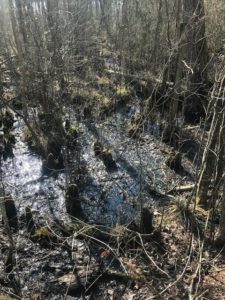 We’ll enjoy some fresh seafood and maybe a drink (but not the captain!) before heading back. As we prepare to leave the dining area, I ask my guests if they would like to see a real cypress swamp before we head back downriver. Perhaps the most northern one on the East Coast. Complete with cypress “knees” and everything. It will make you feel like you’re in the middle of Louisiana. It’s just a short stroll down the boardwalk and under the Route 13 bridge to the nature walk which passes through the swamp.
Join me sometime for a live adventure from Pitts Landing!