
Everyone loves a good loop to paddle. It almost always beats an “out-and-back” style trip because you don’t have to double-back and see the same scenery twice. It also allows you to explore in a one-way direction without the need to leave cars at both the put-in and the take-out spots because the put-in is the SAME as the take-out. And once you complete a loop, you really feel like you’ve accomplished something. You venture out, you explore, you conquer.
The Lower Chickahominy region, located in the Williamsburg area, offers multiple water trails that are complete loops, circumnavigating tidal freshwater marsh islands as well as historic sites. We’ve put together a sample itinerary for exploring the region’s islands, including a few ideas for enjoying the local libations!
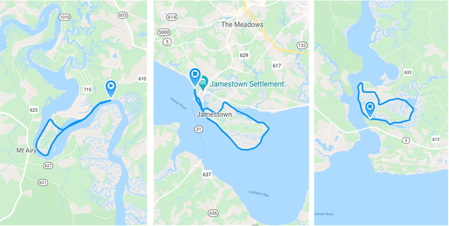
Loop #1: Gordon Island
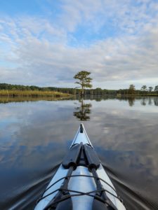
Kick your weekend off with a 6-mile loop around Gordon Island, a freshwater wetland oasis, easily accessible from the Chickahominy Riverfront Park. The park actually has two locations to launch – a soft launch specifically for canoes and kayaks, as well as a boat ramp. If you choose to launch at the boat ramp, you’ll launch right into the loop trail on Gordon Creek. If you launch at the soft launch which is located on the Chickahominy River, you’ll be adding about 1 mile total to your trip, so choose accordingly based on the distance you want to paddle. It’s best if you can time your paddle with the tides. Riding the tide up the Chickahominy and then back out on Nettles Creek is ideal, but if your plans don’t mesh with the tide chart, the currents aren’t incredibly difficult to paddle against.
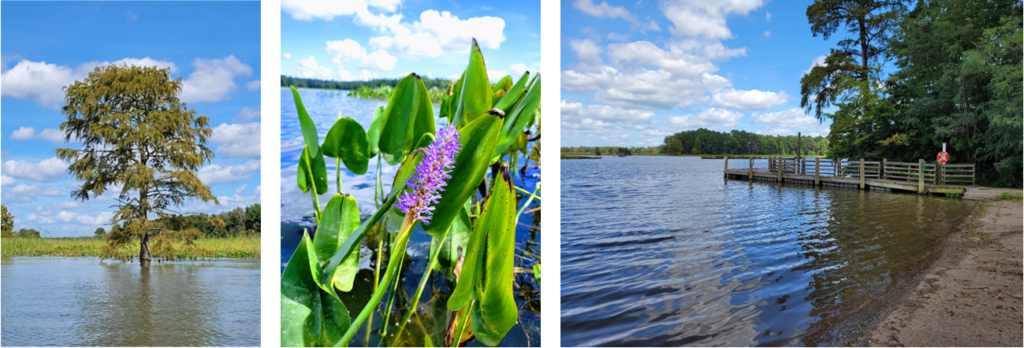
Herons, egrets, and bald eagles are frequent sightings along this loop, but keep your eyes peeled for other wildlife such as migrating songbirds, red-winged blackbirds, and a variety of butterflies throughout the season. The vegetation of the marsh is also spectacular. Pickerelweed, blue iris, rose mallow, and marsh sunflower add beautiful pops of color in the otherwise green marsh vegetation. In addition, several lone bald cypress trees stand tall and majestic, dotting the shorelines of the island.
One danger to be aware of is boat traffic. It would be beneficial to have a tall flag on your vessel so that boaters and those on personal watercraft (i.e. jet skis) know of your presence. Some of the motorboats cruise through Gordon and Nettles Creeks quickly, so it’s best to hug the shoreline as much as you can, so you don’t surprise them as they come around the sharp twists and turns of the creek.
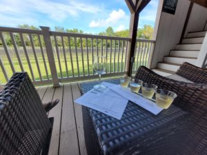 Once you’ve arrived back at the launch, you’ve certainly earned a stop at the nearby Williamsburg Winery. A stop along the Virginia Oyster Trail, the winery is the largest winery in all of Virginia! From picturesque grapevines to charming indoor tasting areas, as well as the Gabriel Archer Tavern for a bite to eat, this place has got it all – a well deserved treat after paddling around an entire island!
Loop #2: Jamestown Island
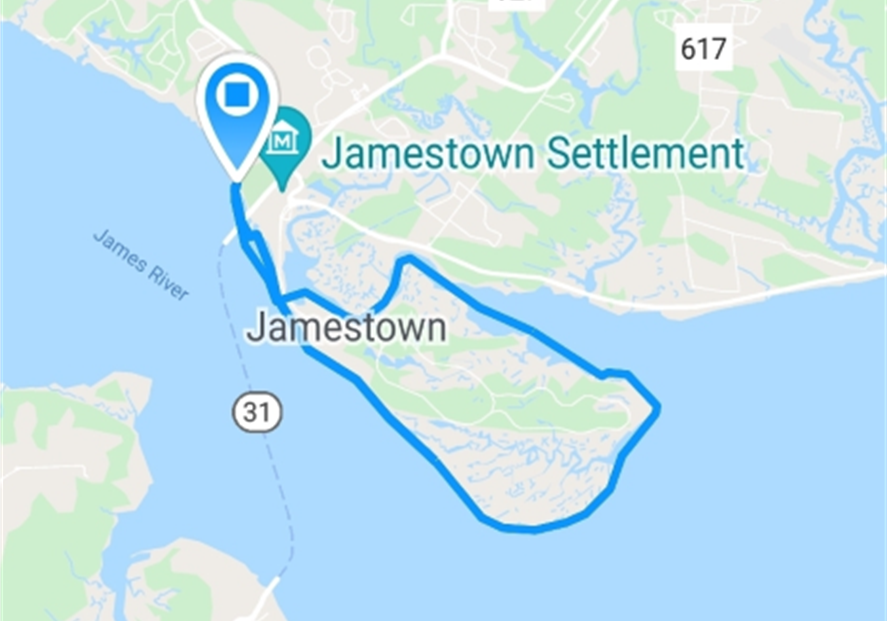
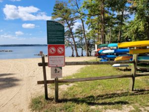
If you’re a very experienced paddler, the 10-mile journey around Jamestown Island is definitely something to tackle! Wind, tide, and boat traffic are all factors that need to be seriously considered before making the decision to paddle this loop, but if the conditions are right, it’s a very rewarding journey.
 Paddling underneath the bridge leading to Historic Jamestowne is probably the most challenging part of the loop because the flow of the river, combined with tidal currents, can form some strong eddies and unpredictable, fast-moving currents. But if you can handle that little inlet, you can likely handle the rest of the loop around the island.
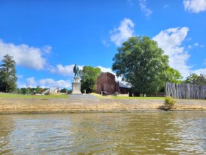 Several sites and monuments of Historic Jamestowne can be seen from the water, but to get the full historical experience, it’s definitely worth exploring the island by land when you’re finished paddling. Many refer to Jamestown Island as the “birthplace of America” since it was the first permanent English settlement in the country. Another highlight of paddling this loop is being able to view the replica ships at Jamestown Settlement.
For a more detailed description of the loop around Jamestown Island, see our recent blog post, “Paddle Around America’s Birthplace in Jamestown, VA.”
 Then, after paddling 10 miles, you and your fellow paddling friends will certainly be hungry! Head on over to Craft 31, another stop along the Virginia Oyster Trail, for delicious food and an incredibly long list of craft beers from all around the region!
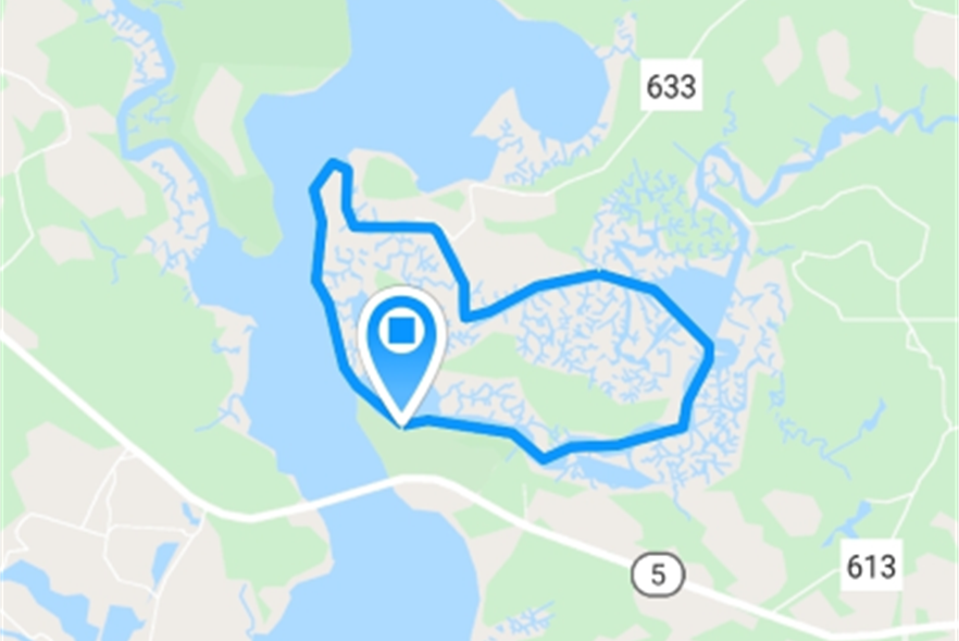
Loop #3: Big Marsh Point
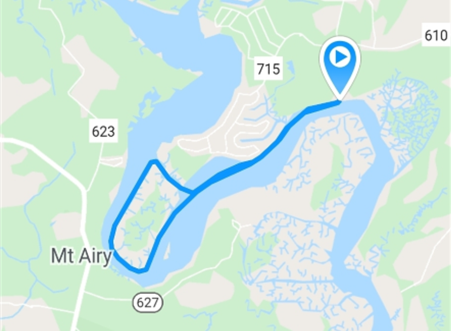
After paddling the busy waters of the James River, we recommend heading upstream and exploring the quieter waters of the Chickahominy. Paddling around the island of Big Marsh Point will be a peaceful change of pace. Although this water trail is marked as an intermediate level on the map, that’s mostly due to the distance (5.5 miles round trip). This part of the river has calmer waters than the James, as it’s less susceptible to wind and tidal currents, and there are fewer large boats to create dangerous wakes.
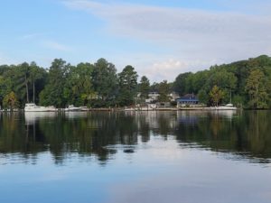
 You’ll want to begin your trip at Brickyard Landing. As you head upstream towards the island, you’ll see some charming riverfront homes, the old riverfront shop “Woodie’s”, and an abandoned barge and rusty, old crane (anyone know what the story is there?)! Then, as you pass the last few houses, you’ll be looking at Big Marsh Point island. There is a small channel that you can turn into on the right, taking you in a northwest direction, but don’t be fooled by the map – this channel is fairly wide and powerboats can easily navigate through, so stay on alert for some recreational fishing vessels to pass by.
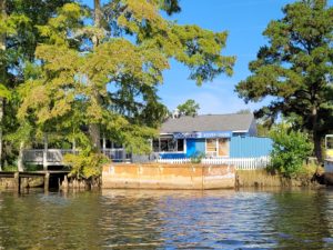
 Once you paddle through the channel, you’ll enter the main river again. Hang a left to continue your loop around the island. There is a restaurant and marina on the far bank though if you need a pit stop! The Blue Heron of Charles City offers up a full menu of fresh seafood, burgers, and cocktails. Just be sure to call ahead and make sure it’s okay to tie up your ‘yaks while dining in.
 As you continue around the island, you’ll be treated to views of gorgeous cypress trees, pickerelweed, and possibly even swarms of swallows as they pass through during migration. Then, before you know it, you’ll be headed back towards those cute riverfront houses again, and back at Brickyard Landing.
Should you choose to spend your paddling weekend with friends and multiple cars, one-way paddling trips are also an option in this region, not just loops! Be sure to check out the regional map for even more paddling trip ideas.
Happy Water Trails!
About the Author: Laura Scharle lives on the Eastern shore of Maryland and is a frequent paddler in coastal Virginia. She is a Virginia certified ecotour guide and is an independent marketing contractor with a focus in ecotourism and heritage tourism. Laura can be reached through our Eastern Shore ecotour guide listings.