
The Eastern shore of Virginia can sometimes feel like just a narrow strip of land with U.S. Route 13 running right down the middle of it and that’s it. But once you start to venture off the highway, you’ll come to realize that the Eastern shore has what seems like endless places to explore and some of the best places to kayak in Virginia. From tiny seaside villages and winding salt marsh creeks on the Atlantic side, to the working waterfronts and scenic vistas on the bayside, the shore is a paddler’s dream.
We recently kayaked the Hack’s Neck and Pungoteague Creek trails which are located just south of the Onancock area. These trails can be accessed from Hack’s Neck, Harborton, and Broadway Landings, and directions can be found on the map on our Eastern shore webpage.
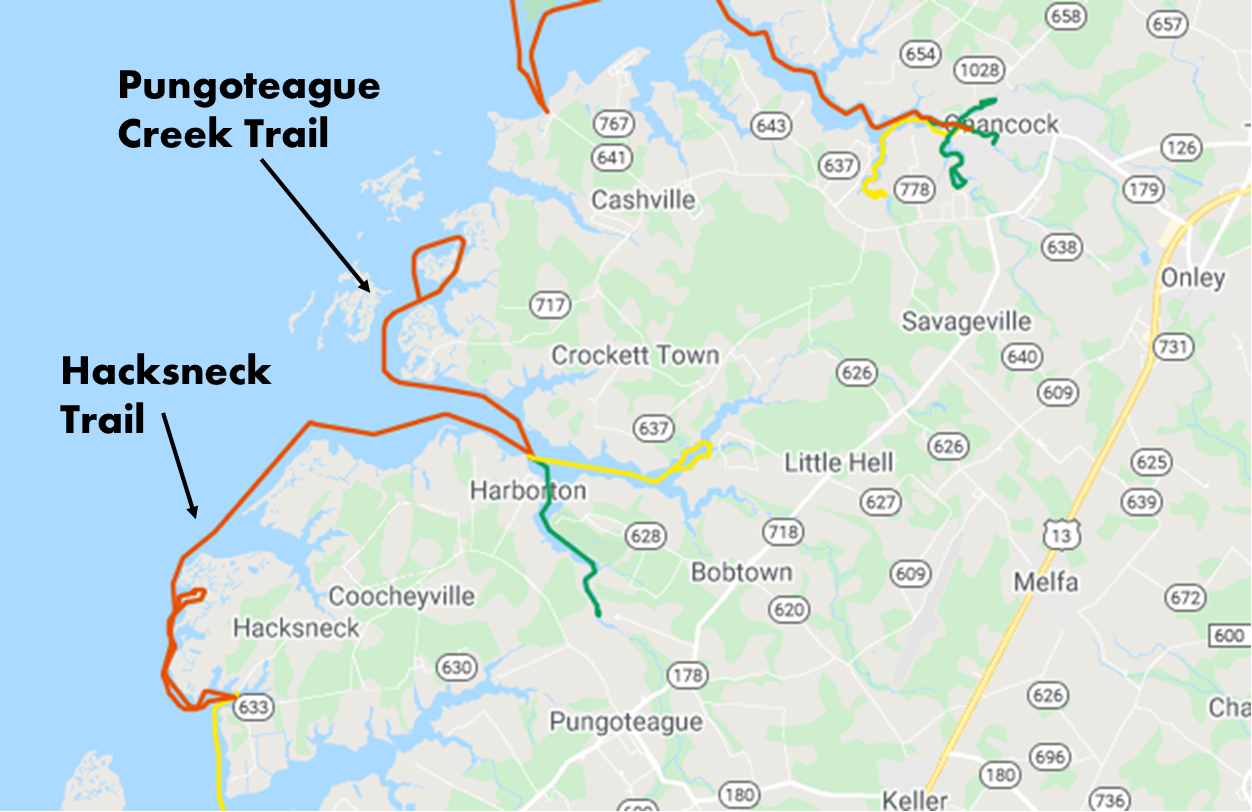
Hack’s Neck Landing is easy to find using our interactive maps, but please note that this landing is only for car-top vessels and is not a boat ramp. Parking is limited, but there is still plenty of space to turn a small kayak trailer around, and enough room to park a small handful of cars. You may feel as though you are driving onto private property as you approach the landing, but trust google maps – you’re in the right place. Just be aware that Hack’s Neck landing is directly adjacent to a working waterfront, so please be respectful and be prepared for the possibility of boat traffic nearby.
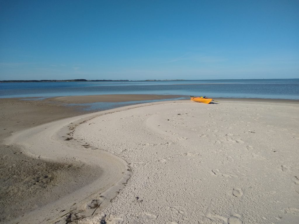
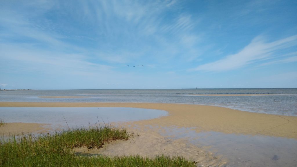
Kayaking north out of Hack’s Neck creek, there are multiple sand bars near the shoreline. At higher tides you can easily paddle between the sand bars and the mainland. At low tide, it can be super fun to get out of you boat, walk around the shoals, and explore a bit. There are also multiple sandy beaches on the mainland in this area, but please keep in mind that they are mostly on private property, so it’s best to explore below the high tide line.
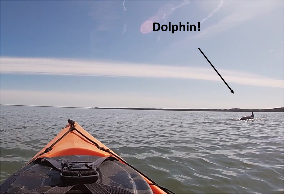
As you head north, stay alert for boat traffic utilizing the channel leading into Pungoteague Creek and Harborton. Because the water is deeper here, you might get lucky and spot some larger marine life such as dolphins – we did! Just another reason to stay alert!

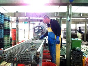
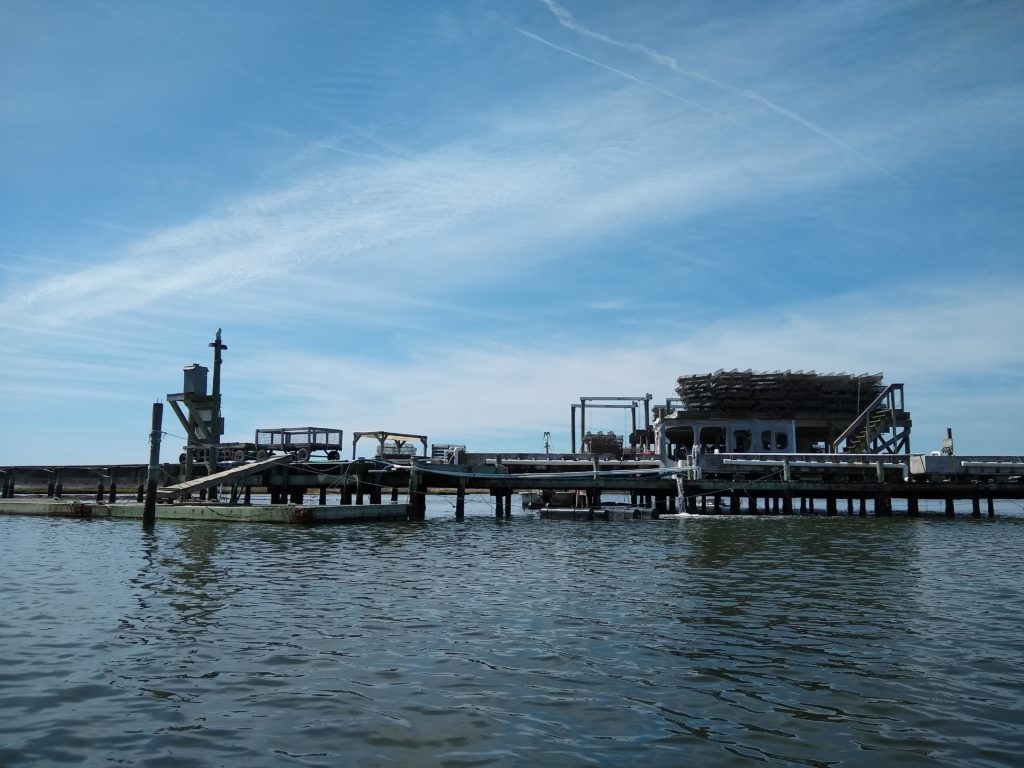
If you choose to paddle the Pungoteague Creek water trail out of Harborton and into the marsh creek to the north, you can’t miss Tarkill Aquaculture, a working waterfront and oyster farm. This aquaculture operation grows oysters for wholesalers, as well as local restaurants. They have a “farm to table” delivery method to supply restaurants in Baltimore, Washington, D.C., and Annapolis with local oysters, and they are large enough to move over 3 million oysters each year!
As you paddle by, you’ll notice a rail system that spans the marsh to provide access from the mainland to the dock, where most of their operation takes place. To learn more, be sure to visit Tarkill Aquaculture Ventures, LLC.
The creek that heads to the north of the oyster farm can be quite shallow, and it is navigable at low tide in a kayak, but it is best if you plan to paddle this area at a higher tide. As you make your way out of the creek and back into the bay, you can head back south to loop back to Harborton, or you can head north for another two miles to arrive at Broadway Landing. Broadway is another landing that is strictly for car-top vessels only, as there is no boat ramp, and the parking is extremely limited (you’d be lucky to fit more than two cars there). Broadway Landing is also best accessed at a higher tide, because at low tide, you may have to drag your kayak about 100 yards.
The total distance to kayak from Hack’s Neck to Broadway is about 8.6 miles. We only advise paddling this route if you are a very experienced paddler, ready for distance, wind, tide, and boat traffic. If you’re incredibly experienced and you have a boat designed for distance, paddling back could be feasible, but 17.4 miles is not for the faint of heart!
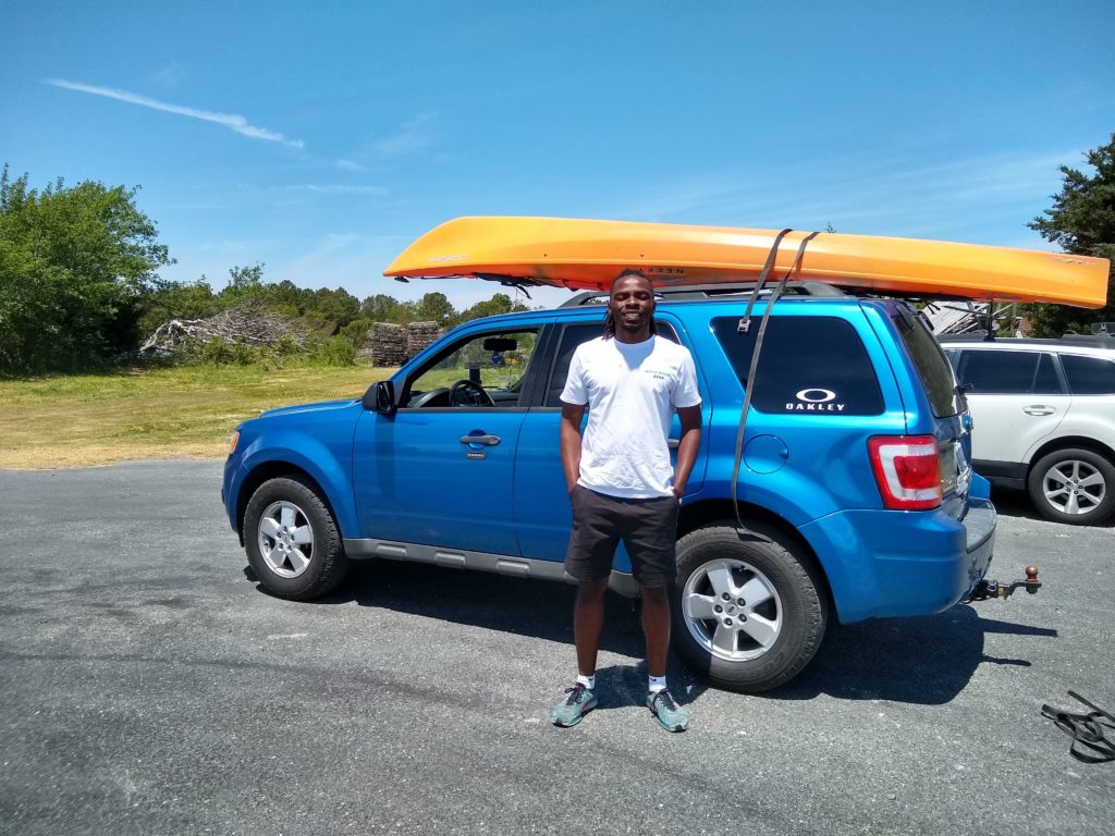
In our case, we paddled the 8.6 miles, and booked a shuttle with Wave Riders, the newest local transportation service on the shore! Our driver, Jahiem, even loaded a kayak on top of the car! Talk about service! We’ll definitely be taking advantage of their services again this paddling season and you should too!
Want to get an even better idea of what paddling is like out of Hack’s Neck, Harborton, and Broadway Landings? Check out this clip we put together from our trip:
Have you paddled out of Hack’s Neck, Harborton, or Broadway Landings? Tell us about it in the comments below! Have questions or need advice? Comment below or send us a facebook message. Happy Water Trails!
About the Author: Laura Scharle lives on the Eastern shore of Maryland and is a frequent paddler in coastal Virginia. She is a Virginia certified ecotour guide and is an independent marketing contractor with a focus in ecotourism and heritage tourism. Laura can be reached through our Eastern Shore ecotour guide listings.