
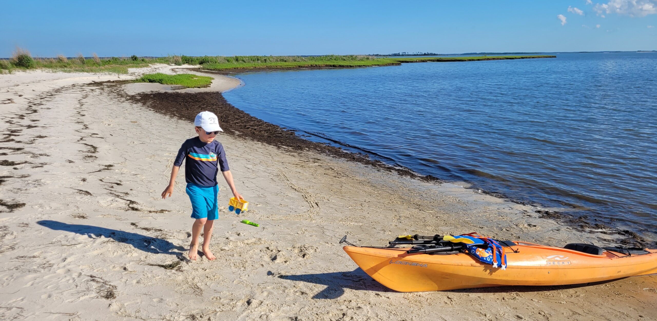
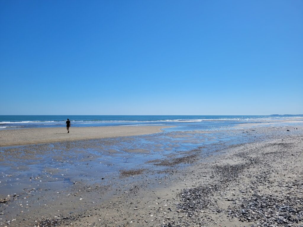
Paddling to a beach sounds delightful, doesn’t it? Beaches that you can drive to are typically mobbed with people. But if you could paddle to a beach that’s not accessible by the masses, you could very well have a beach all to yourself! Strap a beach chair to your kayak, pack a cooler on your paddleboard, and you’ve got plans for total relaxation.
But where can you do this? Aren’t most beaches privately owned? Yes, many of the beaches you see in coastal Virginia are privately owned, but there are some that are public lands, and some that you can visit with prior permission.
We’ve rounded up a list of beaches in coastal Virginia that you can paddle to for a day of fun in the sun.
Guinea Marsh Wildlife Management Area
Region: Middle Peninsula
Launch: Bill Hoggs Landing (end of Kings Creek Rd)
Distance to Beach: 1.5 miles
Wildlife Management Areas (WMAs) are public lands that are managed by the Virginia Department of Wildlife Resources. They are primarily used for hunting and fishing, but those looking for non-consumptive outdoor activities like hiking, paddling, and birding, are welcome to utilize WMAs. If you don’t have a hunting, fishing, or trapping license, or a boater registration, you’ll need to obtain an access permit before visiting.
Once you have launched at Bill Hoggs, start heading east. After about 1.2 miles of paddling, you’ll reach the first beach on the northeast corner of the peninsula. If you want to visit multiple beaches during your trip, keep heading around the bend to the southeast and you’ll find a few more small beaches to explore.
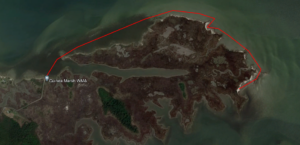
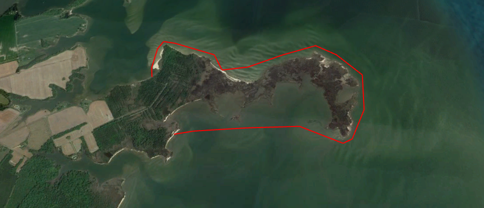
Saxis Wildlife Management Area
Region: Eastern Shore
Launch: Hammock Rd
Distance to Beach: 1.3 miles
Another awesome WMA is located in Saxis on the Eastern shore. The majority of this area is marshland, but there are a few small beaches that are within 1.5 miles of the launch, which is located at the end of Hammock Rd. These beaches are also open for primitive camping. If you’re thinking about camping here, you’ll need to obtain a free camping authorization at Go Outdoors Virginia (you can also purchase the access permit there). Looking at the satellite image, the white, sandy beaches off to the west look incredibly inviting, but please note that that area is privately-owned.
More information about visiting Saxis WMA can be found here.
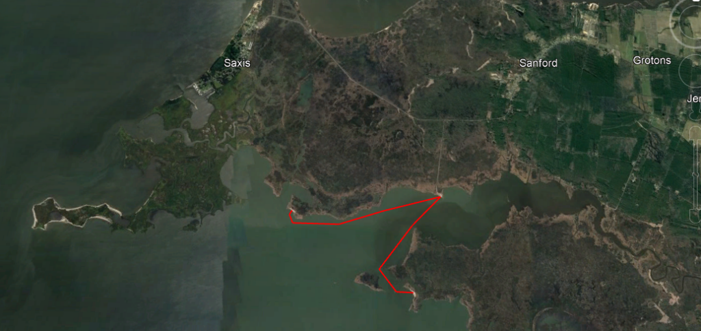
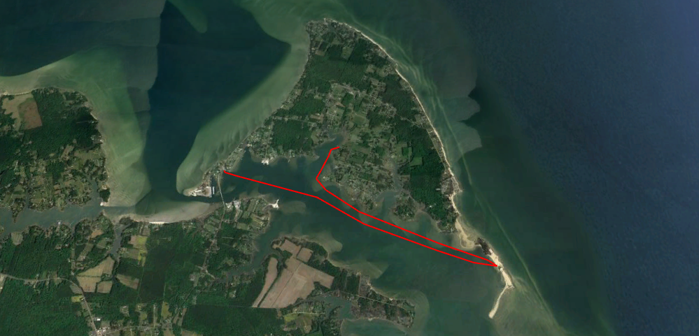
Hollis Island ( a.k.a. “Shark Tooth Island”)
Region: Northern Neck
Launch: Currioman Landing
Distance to Beach: 1 mile
Although Shark Tooth Island is privately owned, you can purchase a permit to visit from the owners of the island. Details can be found here. From Currioman Landing, it’s just about a mile of paddling before you reach the beach. But as you can see from the map, you can spend all day circumnavigating the island and stopping on multiple beaches along the way. Total mileage is about 4.5 miles.
Please keep in mind that the waters of the Potomac River can be rough on any given day. Even if winds are calm, boat wakes can be large and frequent. Less experienced paddlers should stay between the island and the mainland.
Gwynn’s Island
Region: Middle Peninsula
Launch: Milford or Grimstead Landings
Distance to Beach: 2.5 miles
The southeast corner of Gwynn’s Island welcomes paddlers! This spit of beach is owned by the Mathews Land Conservancy and is known as Sandy Point. The conservancy’s mission is to provide and expand public access sites across the county and operate solely on donations and grants. If you enjoy visiting this beach, consider making a donation to ensure it is protected for generations to come.
There are two launching sites that are within 2.5 miles of Sandy Point. While Milford Landing is slightly closer, the launch is actually a pier, so unless you are skilled at hopping in your kayak from a dock, we recommend launching at the Grimstead boat ramp. Grimstead is also nice because it’s right next to Hole in the Wall Waterfront Grill, which makes for the perfect post-paddle lunch or happy hour.
Dameron Marsh Natural Area Preserve
Region: Northern Neck
Launch: Dameron Marsh Soft Launch
Distance to Beach: 0.7 miles
If you’re really looking to get off the beaten path, Dameron Marsh Natural Area Preserve might be exactly what you’re looking for. Natural Area Preserves are lands protected under Virginia’s Department of Conservation & Recreation and have some of the highest levels of protection due to rare species and sensitive cultural resources found on them. When visiting Dameron Marsh, it’s important to adhere to all signage as some areas can be restricted during certain bird nesting seasons.
From the launch, the closest beach is less than 0.1 miles away! This is perfect if you’re a beginner paddler, or if you have little ones with you. The next beach is another 0.6 miles to the east. Paddle around the bend a little and you’ll find it. If you’re wanting a longer, more adventurous excursion, keep paddling around the peninsula and you’ll find some more beaches to explore on the south side of the preserve. The beach on the south side is a little over 3 miles from the launch.
Barrier Islands
Region: Eastern Shore
Launch: (see many options on the Eastern Shore map)
Distance to Beach: Varies from 2 to 8 miles
The barrier islands along Virginia’s eastern shore make up one of the longest stretches of undeveloped coastline along the entire Atlantic coast. Paddling out to any of the islands is an experience like none other. But not all of the islands are open to public access, and many have seasonal restrictions to help conserve some rare and endangered bird species that utilize the islands for nesting grounds.
Paddling out to the barrier islands is also an adventure that should only be embarked upon if you are an experienced paddler, or you are going with an experienced guide. Strong tidal currents and unpredictable weather can make for treacherous conditions. For information on which islands allow visitation, check out Explore Our Seaside. To find an experienced guide, take a look at our list of Certified Ecotour Guides.
More information about paddling to Cedar Island can be found here.
Happy Water Trails!
About the Author: Laura Scharle lives on the Eastern shore of Maryland and is a frequent paddler in coastal Virginia. She is a Virginia certified ecotour guide and is an independent marketing contractor with a focus in ecotourism and heritage tourism. Laura can be reached through our Eastern Shore ecotour guide listings.