
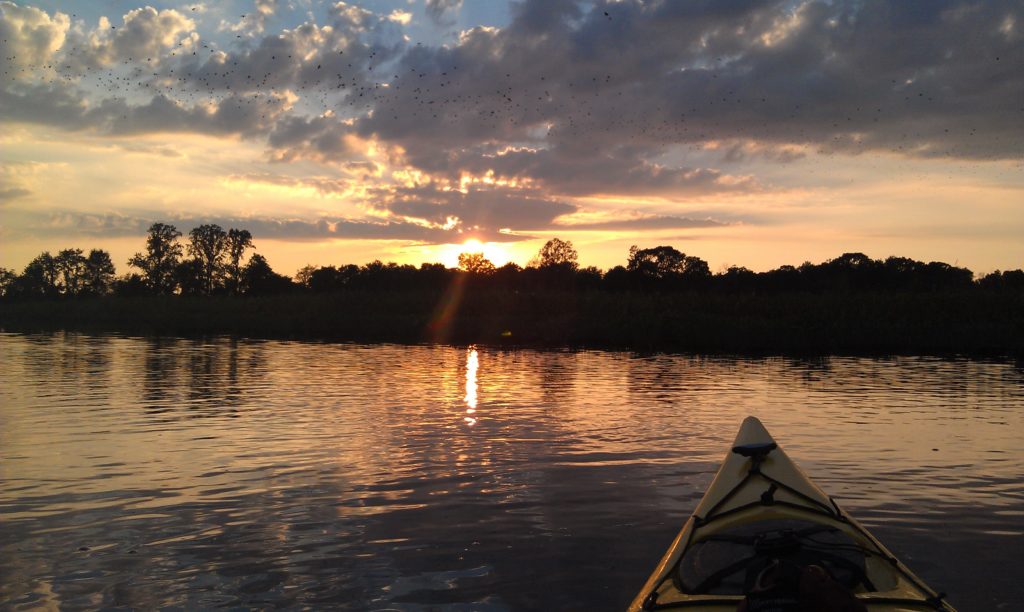
Kayaking is one of the best low-impact forms of water sports you can choose. No carbon emissions, no noise pollution, and no large wakes to cause erosion. Another great aspect of kayaking is the ability to explore areas in which boats can’t reach, such as salt marshes and shallow, narrow creeks. With the increased popularity in paddling in recent years, and particularly over the last year during the pandemic, more and more people are beginning to reach areas that never saw many people in the past. More people now have access to deserted beaches, pristine marsh creeks, and cypress swamps than ever before. And while it’s exciting to hear about more people exploring the great outdoors, higher visitation results in more impact on the natural resources, some of which are incredibly fragile.
![]() First and foremost, we recommend that all paddlers adhere to the 7 Leave No Trace Principles to establish a baseline knowledge of environmental stewardship. These principles cover things like tips on planning trips, how to dispose of waste, and encouraging everyone to “leave what you find.”
First and foremost, we recommend that all paddlers adhere to the 7 Leave No Trace Principles to establish a baseline knowledge of environmental stewardship. These principles cover things like tips on planning trips, how to dispose of waste, and encouraging everyone to “leave what you find.”
Once you have a good understanding of Leave No Trace, it’s important to dive a little deeper and start to familiarize yourself with the local ecosystems of where you’ll be paddling.
Maybe you’re new to kayaking, or maybe you’re an old salt, but when you’re exploring coastal Virginia’s water trails, we encourage you to understand the waters in which you’re paddling, and the specific lands you may be visiting. But researching this stuff ahead of time can be daunting – state parks, county parks, national parks, wildlife refuges, natural area preserves, marine protected areas – How do you know what’s what? When can you visit? How can you visit? What’s off limits? It can be very confusing, so that’s why we put together this “cheat sheet” of a blog post to prepare you to be the most eco-friendly kayaker you can be!
Let’s break it down by region:
The Northern Neck
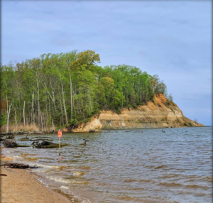
Westmoreland State Park: This park is known for its famous fossil beach where visitors can spot ancient shark teeth and other prehistoric finds. However, the park has some towering cliffs that are incredibly susceptible to erosion and very dangerous to walk under. Landing of kayaks is prohibited in these areas so keep your distance from the cliffs and obey all posted signage.
Bush Mill Stream Natural Area Preserve: This area provides excellent nesting habitat to a variety of colonial nesters and birds of prey. Stay on marked trails and only launch and land kayaks in designated areas. Pets must be leashed.
Dameron Marsh Natural Area Preserve: Shorelines are typically closed from mid-April to mid-September to protect the nesting grounds of several threatened and endangered shorebirds species. This area is also critical habitat for the globally rare beach tiger beetle. Their larvae are under the sand in the intertidal zone, so tread lightly and refrain from digging or activities that cause heavy compaction of sand. Pets must be leashed.
Hughlett Natural Area Preserve: Small portions of the preserve’s shorelines can be closed to protect nesting shorebirds, but closures have been minimal in recent years. This area is also habitat for the tiger beetle, so again, tread lightly and minimize your time in the intertidal zone. Pets must be leashed.
Rappahannock River Valley National Wildlife Refuge: Stay on marked trails and only launch and land kayaks in designated areas. Pets are prohibited.
The Middle Peninsula
Bethel Beach Natural Area Preserve: The sandy spit on the southern tip of the preserve is closed from mid-April to mid-September to protect several species of threatened and endangered nesting shorebirds. This area is also critical habitat for the globally rare beach tiger beetle. Their larvae are under the sand in the intertidal zone, so tread lightly and refrain from digging or activities that result in heavy compaction of sand. Pets must be leashed.
New Point Comfort Natural Area Preserve: Designated by the State as a Natural Area Preserve, this spot is owned and managed by The Nature Conservancy. Stay on marked trails. Pets must be leashed. Landing of kayaks on preserve shorelines is permitted unless otherwise noted. Please be aware that most of the sandy shorelines along the tip of the peninsula are on private land.
The Eastern Shore
Chincoteague National Wildlife Refuge: This refuge is home to threatened and endangered shorebirds, the once endangered Delmarva fox squirrel, wild horses, and a variety of migratory birds. Paddling inside the refuge impoundments is strictly prohibited. For information on where paddling is permitted vs. prohibited throughout the refuge, check out this handy map.
Wallops Island National Wildlife Refuge: While paddling in the marsh creeks behind Wallops Island is permitted, the refuge itself is closed to visitors, so do not land your kayak on any of the shorelines.
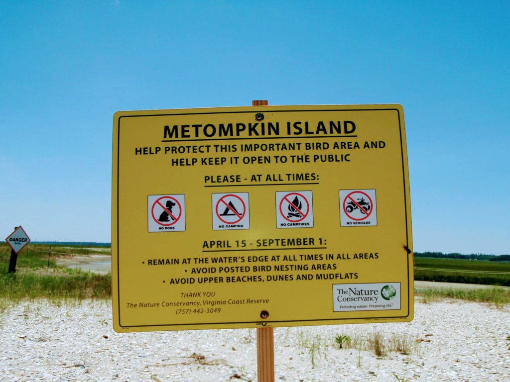
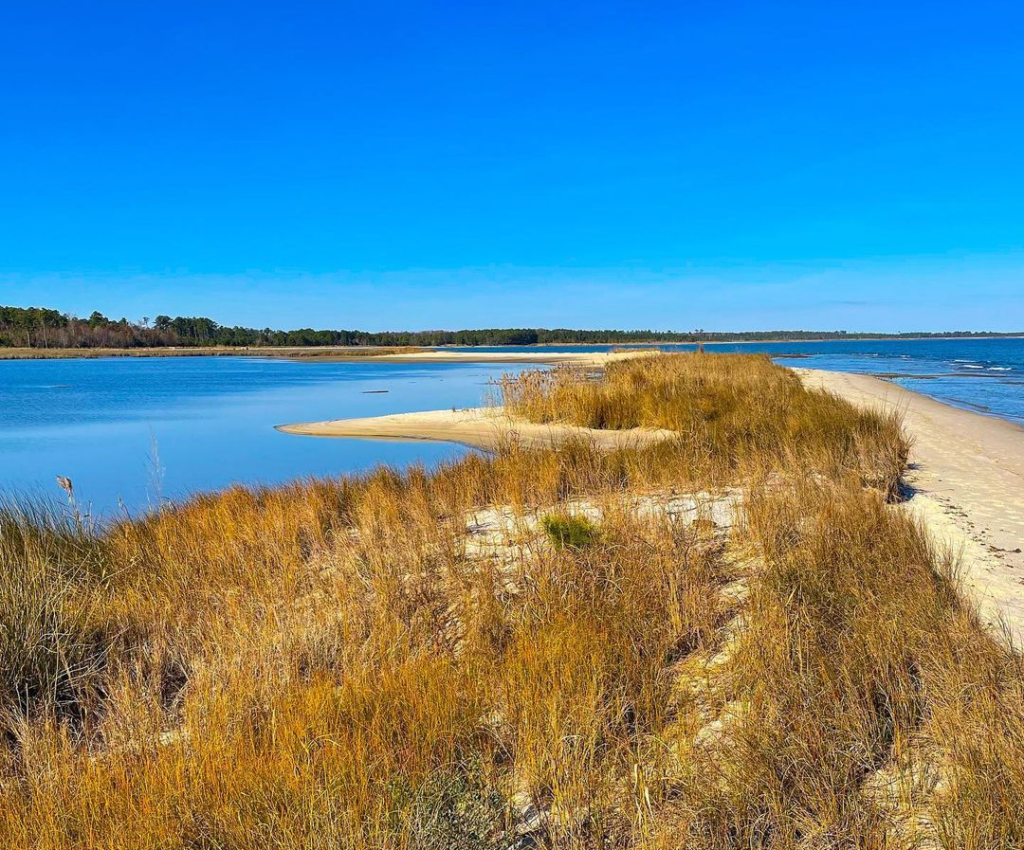
Metompkin, Cedar, and Parramore Islands: These islands are all managed by The Nature Conservancy and provide critical nesting habitat for a variety of threatened and endangered shorebirds. These islands are closed above the high tide line from April through August, so be sure to stay on the water’s edge. For more information on permitted activities, please visit Explore Our Seaside.
Mark’s & Jack’s Islands and Parker’s Marsh Natural Area Preserves: These preserves provide important habitat for marsh nesting birds and the globally rare beach tiger beetle. Access is restricted to educational and research activities. Prior approval for visitation can be arranged by calling (757) 787-5989.
Savage Neck Dunes Natural Area Preserve: This preserve has seen a sharp increase in visitation recently and it is possible that visitation could be restricted in the future. Please check the website before visiting. This spot provides more critical habitat for the globally rare tiger beetle. Their larvae are under the sand in the intertidal zone, so tread lightly and refrain from digging or heavy compaction of sand. Steep, fragile dunes exist at this site so it’s important to stay on the trails and beach. Climbing dunes not only causes erosion, but it can also be incredibly dangerous.
Cape Charles and Picketts Harbor Natural Area Preserves: Cape Charles NAP has a walking trail that can be accessed from town. However, the shorelines at both the Cape Charles NAP and Picketts Harbor NAP are closed to foot traffic and the landing of boats and kayaks is strictly prohibited, so do not plan for a picnic lunch in either of these areas.
Kiptopeke State Park: Some of the shorelines are high in elevation and susceptible to erosion. It’s extremely important to obey all posted signage and stay on marked trails when visiting. Landing of kayaks should be limited to the park’s recreational beaches and the boat ramp area.
Eastern Shore of Virginia National Wildlife Refuge: While you can launch a kayak from the Wise Point boat ramp within the refuge, many areas are closed to visitation such as the beach on the southern tip of the peninsula, Skidmore Island, and parts of Racoon Island.
Fisherman Island National Wildlife Refuge: This refuge provides important habitat for a variety of nesting shorebirds, as well as nesting grounds for the diamondback terrapin. Visitation to the island is prohibited, unless on a scheduled tour led by refuge staff during the winter.
Not sure if you’ll be paddling near any of these areas? Use this map to locate all of these environmentally and ecologically sensitive areas:
About the Author: Laura Scharle lives on the Eastern shore of Maryland and is a frequent paddler in coastal Virginia. She is a Virginia certified ecotour guide and is an independent marketing contractor with a focus in ecotourism and heritage tourism. Laura can be reached through our Eastern Shore ecotour guide listings.