
The Lower Chickahominy region is centered around the tidal portion of the Chickahominy River located on the southernmost peninsula on the western shore of the Chesapeake Bay. The region includes the Counties of Charles City, James City, and New Kent. The Lower portion of the Chickahominy River stretches from Walkers Dam at the eastern edge of Chickahominy Lake downstream to the confluence with the James River. It is home to some of the most impressive tidal freshwater vegetation in the Mid-Atlantic region. Scientists performing fieldwork noted that the tidal freshwater wetland communities were among the highest quality remaining along Virginia’s tidal rivers.
 Photo Source: Chesapeake Bay Magazine
The Chickahominy River was named after the Chickahominy Indian Tribe, a Native American tribe that was settled along the river when the English colonists arrived in 1607. Currently, the region is home to two Tribes: the Chickahominy Tribe based in Charles City County and the Chickahominy Tribe – Eastern Division based in New Kent County. The Lower Chickahominy area is about as close as you can get to the first steps of English colonization of the mid-Atlantic; Jamestown was established in what is now southeastern James City County.
In this four-part series, we will explore four different public access sites you can visit along the Lower Chickahominy River. Each site offers visitors a wide range of recreational opportunities for outdoor enthusiasts. First up in the series is the Chickahominy Wildlife Management Area.
Chickahominy Wildlife Management Area
The Chickahominy Wildlife Management Area is situated on the eastern shores of the Chickahominy River. The management area consists of mainly woodlands, with a variety of wildlife habitats. With its 5,217 acres of land outdoor enthusiasts can engage in outdoor recreational activities such as hunting, fishing, boat access, horseback riding, wildlife viewing, primitive camping, and hiking.
The Chickahominy River flows on the eastern boundary of the management area near the confluence of the James River. At the western edge, Morris Creek begins and flows along the management area’s southern boundary. Morris Creek is a tidal tributary of the Chickahominy River with pristine waters and vast wildlife viewing opportunities, this is the place to be if you are a paddler!
The Morris Creek boat ramp gives access to both the Chickahominy and James River and provides fishing access on site. Exploring this area is especially intriguing to paddlers as it is nearly untouched terrain full of wildlife viewing opportunities. While paddling be sure to check out the bald cypress trees for any bald eagles or ospreys, as you will often find their nests above.
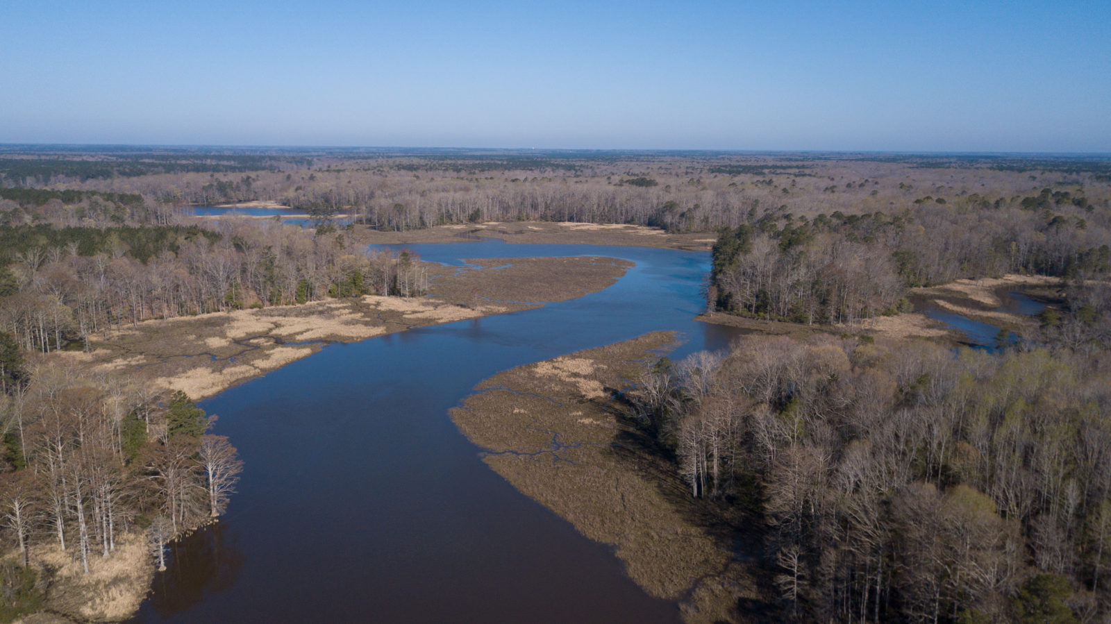 Photo Source: DWR
Nature and culture-based recreation and learning opportunities abound in the Lower Chickahominy region. The Lower Chickahominy River boasts some of the most unique and valuable natural resources in Virginia. The Chickahominy Wildlife Management Area is no exception. Paddlers will find the Morris Creek boat ramp to be an enticing location for their next put-in as it is well-known for its untouched beauty. If fishing is more your speed, the ramp also offers fishing access for those looking to make their next big catch. If you are looking for a way to retreat and recreate, the Chickahominy Wildlife Management Area is the place to be!
Be on the lookout for the second part of the series where we will explore Brickyard Landing in James City County!