
Often forgotten on Virginia maps, the Eastern shore has a culture all of its own. This narrow strip of land between the Chesapeake Bay and the Atlantic Ocean may seem like just a highway when you pass through on Route 13, but as you begin to explore the back roads and quaint, historic towns, the Eastern shore quickly captures your heart. From the charming historic districts of Cape Charles, Onancock, and Chincoteague, to the wild coastlines teeming with wildlife, the Eastern shore is the perfect location for a weekend paddling vacation – or as we like to say, “paddle-cation.”
When you take your first glance of the water trails map of the Eastern shore, it appears to be dominated by red, advanced level trails, particularly on the seaside where there aren’t as many narrow, protected creeks to explore. And the beginner and intermediate trails are even fewer in the southern portion of the region, down near Cape Charles.
But if you’re not an advanced paddler, you definitely don’t want to skip Cape Charles! There are several easy and intermediate trails tucked away throughout the area that you don’t want to miss. Throw in some fresh seafood, craft brews, and a stunning hike, and you’ve got the perfect Cape Charles escape ahead of you.
The following suggested itinerary is just what you need to start planning your getaway.
Friday: Paddling Kiptopeke State Park
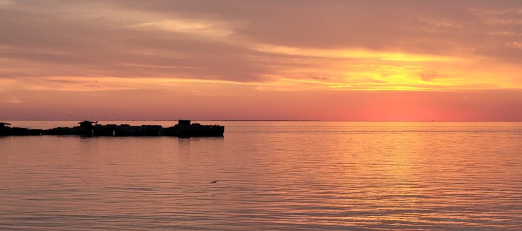
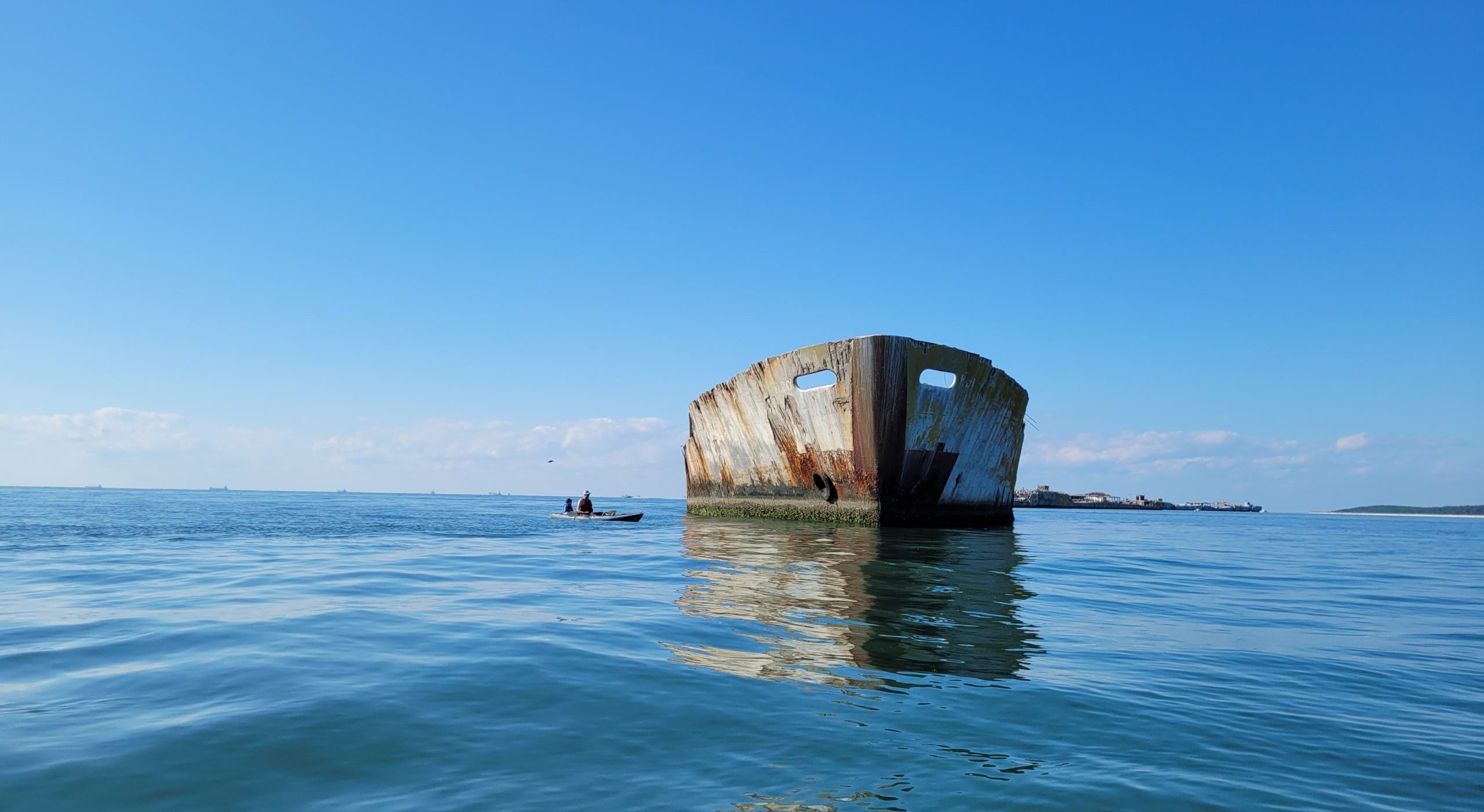
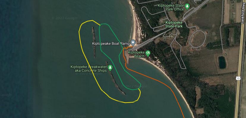
Kick off the weekend with a sunset paddle around the old, concrete ghost ships of Kiptopeke State Park. Concrete ships are few and far between throughout maritime history, but you can paddle up to a whole line of them just off the coast of Kiptopeke. These ships were placed here in 1948 to help create a breakwater and protect the former ferry terminal from harsh wind and waves. Today, the ferry terminal serves as an excellent fishing pier for the state park.
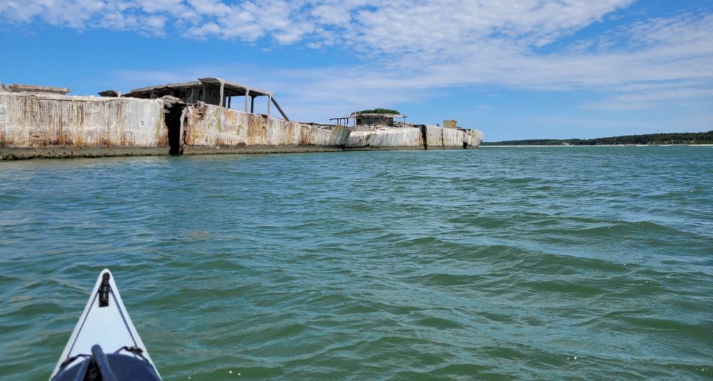
When approaching the ships, it’s important to stay at least 50’ away, and also note the direction of the wind. Beginner paddlers should stick to the east side of the ships, particularly if the breeze is coming out of the west. As you paddle by these ghostly structures, it will become clear that harsh weather has certainly taken a toll over the years. Some of the ships have massive cracks in the middle, almost wide enough for a small boat to fit through. Other ships have plants growing and birds nesting on the decks. Paddling downwind of the ships is important for safety reasons, but paddling downwind can also be quite stinky at times, as the bird droppings on the ships create a… unique… stench in the air.
Paddling out to the ships is a quick trip from the boat ramp or the beach of Kiptopeke State Park. The closest ship is just a quarter mile from the ramp. On the way to and from the ships (and if the wind is calm, feel free to venture around the ships), be sure to be on the lookout for wildlife. Dolphins and sea turtles are frequent sightings in this area, and pelicans are almost always perched on top of the ships.
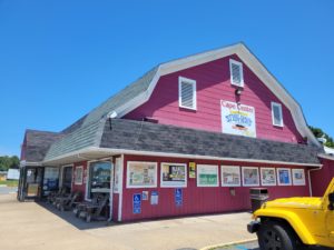 After paddling and watching a gorgeous sunset over the Chesapeake, you’re bound to be a bit hungry for some local seafood! Head back out to the highway and stop by Sting Ray’s restaurant. It might not look like much more than a gas station from the highway, but if you make your way to the back of the store, you’ll find a delicious menu packed with local soft shell crabs, oysters, fish & chips, and so much more.
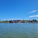
Saturday: Oyster Harbor & A Coastal Hike
After a restful Friday evening, get ready for a day packed with adventure. Before heading out, we highly recommend packing a lunch, or grabbing a sandwich to go (and maybe even breakfast too!) from Coastal Baking Co.
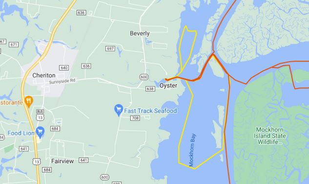
Paddling out of Oyster Harbor can make for a beautiful paddling experience, but it’s important to check the tides before planning out your day – plan on paddling when the tide is up. If high tide is in the morning, paddle out of Oyster in the morning and hike in the afternoon. If the tide is low in the morning, flip your plans and go for a hike first, and paddle from Oyster in the afternoon.
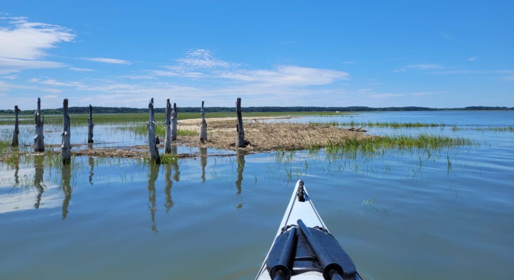
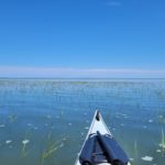
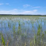
Many of the seaside water trails on the Eastern shore are at an advanced level because of strong tidal currents and long distances. But paddling a shorter distance out of Oyster Harbor at high tide is definitely doable for the intermediate paddler, and just a 4-mile loop can provide ample wildlife sightings and some beautiful seaside scenery.
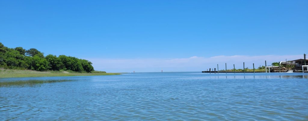
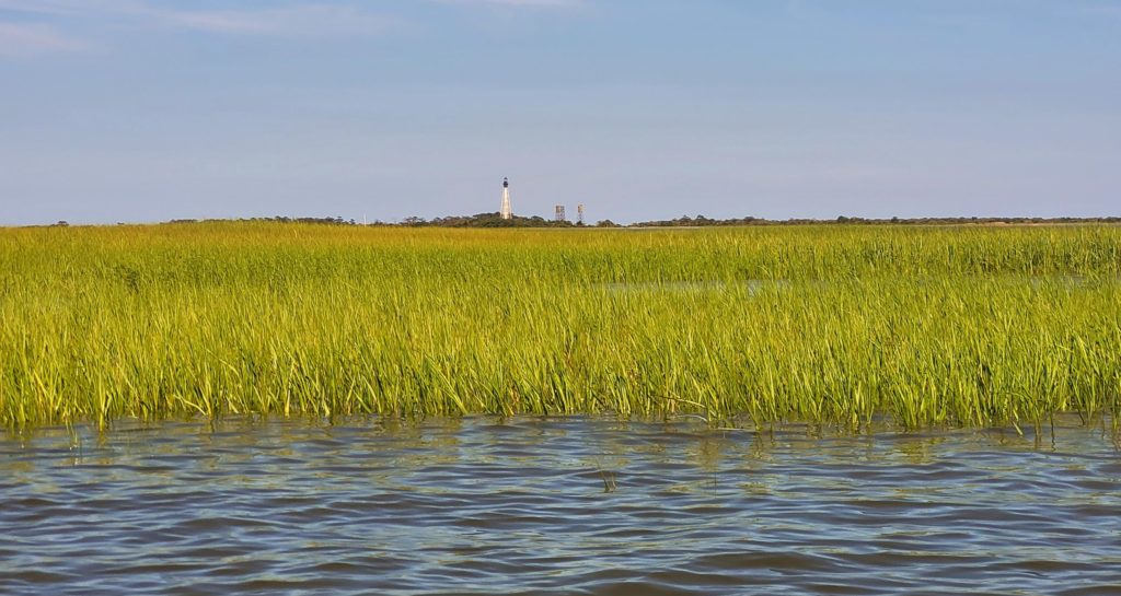
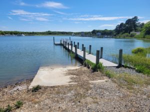 The Oyster boat ramp has a smaller ramp and floating kayak launch which is super helpful if the ramp is busy with boaters. As you head out of the harbor, it feels like you are headed out to sea with not a single man-made structure anywhere in sight, except for the Cape Charles lighthouse which appears to be no bigger than a toothpick to the south. And looking out to the east, with nothing on the horizon except for marsh grasses, you’re fooled into thinking the ocean is right around the corner – it’s actually still seven miles away! That feeling of knowing there’s nothing but wild, coastal landscape between you and the ocean for seven miles is a feeling you probably can’t get anywhere else in Virginia!
Paddling out of Oyster in late spring and early summer is a real treat if you’re hoping to catch a glimpse of shorebirds. American oystercatchers are frequent sightings on the oyster bars along the edge of some of the marsh islands closest to the boat ramp. Herons, egrets, pelicans, and white ibis are also plentiful in this area. Just be sure to stay in your kayak and not venture onto any of the beaches where birds could have sensitive nesting areas. To learn more about conservation work happening in this area, be sure to check out Explore Our Seaside.
The reason we recommend paddling this area at high tide is because large portions of Mockhorn Bay can turn into very shallow waters and mudflats at low tide, forcing paddlers to share the marked channel with boat traffic (or trekking through super soft marsh mud!). And if you’re feeling adventurous enough to paddle a meandering marsh creek, your chances of staying afloat are much higher at high tide. In addition, low tide can cause paddlers to run aground on oyster bars, causing damage to kayaks and paddleboards.
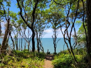
For the other half of your Saturday, take a break from paddling and enjoy a bit of the Cape Charles area by land! Kiptopeke State Park offers several miles of trails, one of which traverses the coastline with stunning views of the Chesapeake. Another great hike is Savage Neck Dunes Natural Area Preserve, a short walk through the woods and towering sand dunes, ending on a secluded beach. When visiting Savage Neck Dunes, please adhere to all posted rules and regulations to help preserve sensitive habitat.
After paddling and hiking all day, take the evening to relax and unwind with a good meal and a cold brew! The historic district of Cape Charles has several fabulous, local dining options to choose from such as Kelly’s Gingernut Pub, Deadrise Italian Kitchen, and Cape Charles Brewing Company.
Sunday: Eastern Shore National Wildlife Refuge
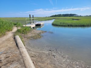 No trip to the southern tip of the Eastern shore is complete without a stop at the Eastern Shore National Wildlife Refuge. Within the refuge is the Wise Point boat ramp which has a separate, free kayak launching area. Paddling closer to high tide is preferable as the kayak launch can sometimes be tricky to use at low tide, but if your schedule only allows you to paddle at low tide, you can always pay the ramp fee and launch alongside the boats in deeper water.
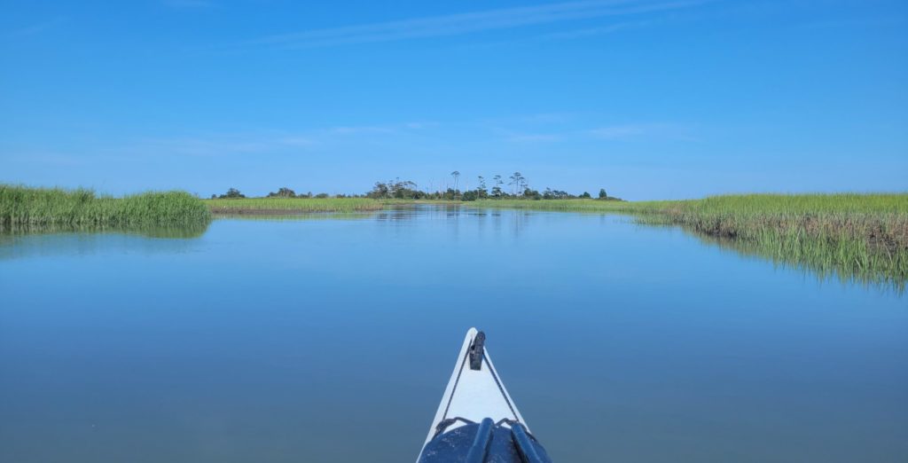
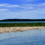
If you are lucky enough to paddle at high tide, the winding creek near the kayak launch is fabulous for beginner paddlers. Protected from boat traffic and wind, the creek is a beautiful spot to explore before heading out towards Raccoon Island. The creek that cuts through Raccoon Island is also suitable for beginners, but just be aware that the channel between the mainland and the island can have strong tidal currents and boat traffic. Looping around the north or south end of Raccoon Island is more suited for intermediate paddlers due to being over 4 miles, but it’s worth the extra mileage to see some great views of the Cape Charles lighthouse and the Chesapeake Bay Bridge-Tunnel in the distance.
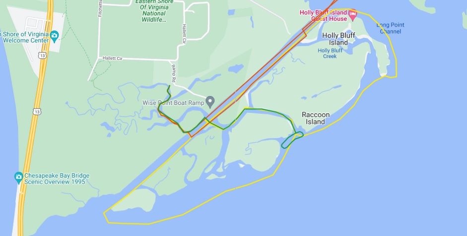
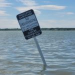
Portions of Raccoon Island are privately owned, and other portions are closed for nesting birds from March 1 – September 15, so it’s best to stay in your kayak while exploring the water trails around the island.
After paddling all three trails over the weekend, you might be ready for a nap! But if you’re still wanting to explore, the Eastern Shore National Wildlife Refuge has several walking trails, a visitor center, wildlife observation decks, and some cool WWII history to explore.
Happy Water Trails!
About the Author: Laura Scharle lives on the Eastern shore of Maryland and is a frequent paddler in coastal Virginia. She is a Virginia certified ecotour guide and is an independent marketing contractor with a focus in ecotourism and heritage tourism. Laura can be reached through our Eastern Shore ecotour guide listings.