
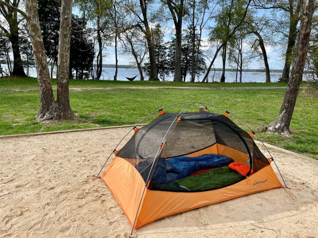
If you’ve been thinking about trying out kayak-camping, make this the year you give it a whirl. Or if you’re an experienced paddler that has completed countless multi-day tours, we invite you to explore the paddle-in campsite options in coastal Virginia. From the busy waters of the Potomac River to the deserted beaches of the Eastern shore, Virginia’s tidal waters have something for every adventurous paddler.
1. Westmoreland State Park
Region: Northern Neck
Water Trail: Potomac River Long Distance Trail
Reservations: Contact westmoreland@dcr.virginia.gov to apply for a permit
Campsite Location: https://goo.gl/maps/XNDt7X3KcQDmgvUF9
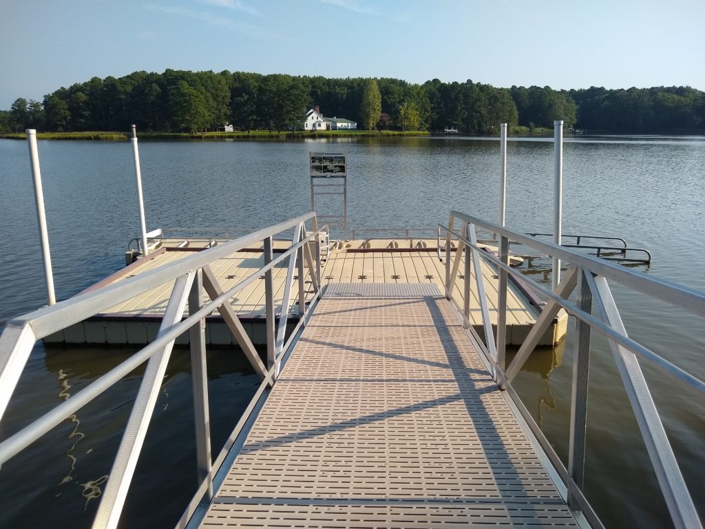
Known for fossil hunting, hiking trails, and sandy beaches along the Potomac, Westmoreland State Park also has a group paddle-in campsite, recently opened in 2017. Be sure to contact the park well in advance to fill out the permit application needed to reserve the site. Convenient restrooms are located just a short walk down the beach!
2. Saxis Wildlife Management Area
Region: Eastern Shore
Water Trail: Cattail Creek & Messongo Creek
Reservations: Written authorization required from DWR – click HERE for more info
Suggested Campsite Location: https://goo.gl/maps/QcNBPMR5VtYfgNpFA
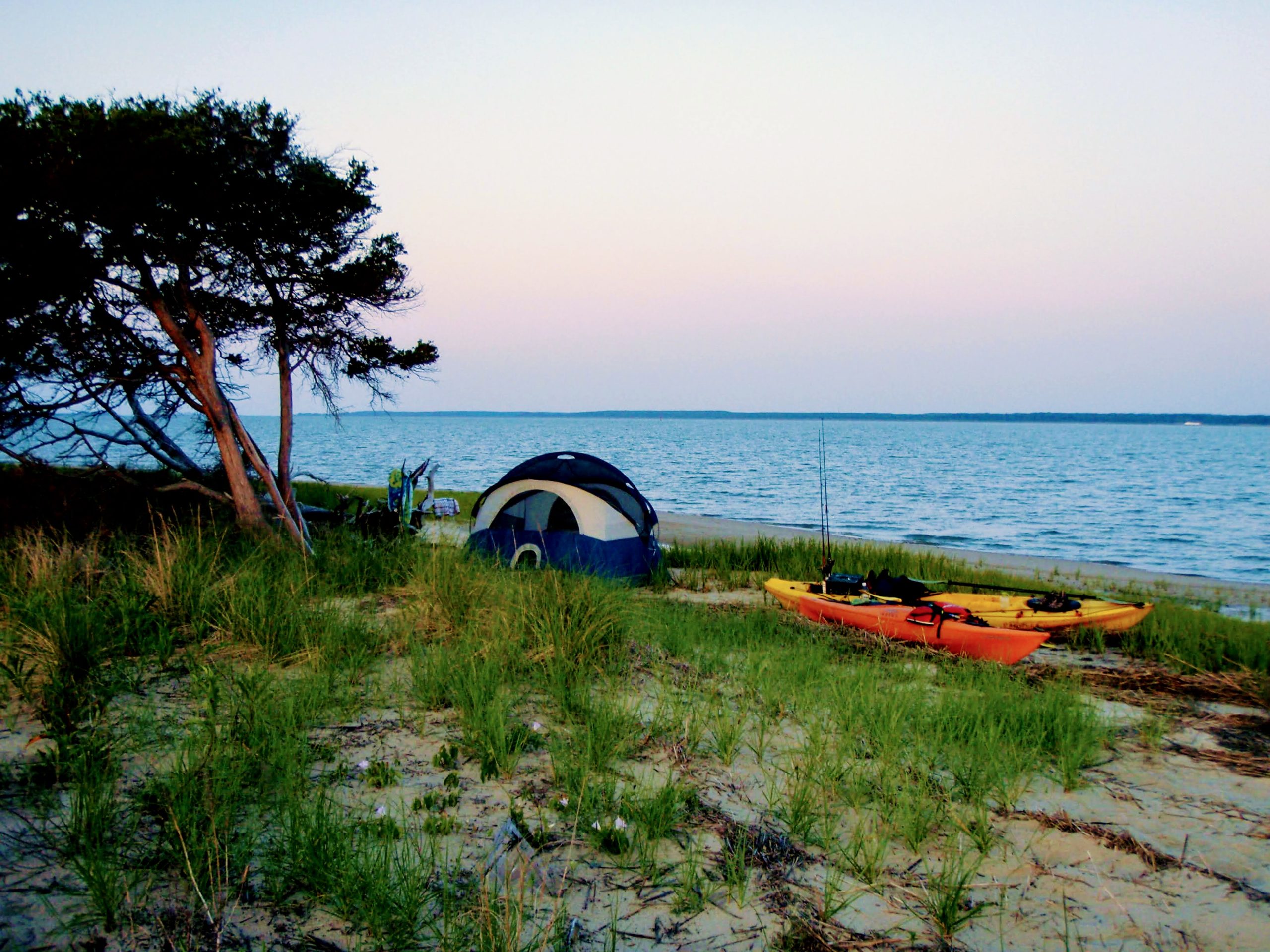
If you’re looking for a true primitive camping experience with nobody around for miles, paddling the Saxis Wildlife Management Area will be a real treat. Small, sandy beaches dot the coastline of the expansive salt marshes that are suitable for pitching a tent. There are a number of places to launch in the area, depending on how far you’d like to paddle, but the closest spot is Hammock’s Landing, leaving just over a mile to reach one of the small beaches. For a longer paddle, consider launching from the Saxis harbor, Guardshore beach, or Hunting Creek. To see all the public access points in the area, be sure to check out our Eastern Shore interactive map. The Saxis Wildlife Management Area has no facilities so be sure to Leave No Trace. Read email more details about kayak camping in Saxis at here.
3. Saint Salty Campsite on the Chesapeake Bay
Region: Middle Peninsula
Water Trail: New Point Comfort Trail
Reservations: Online
Campsite Location: https://goo.gl/maps/R1EL4BZCQLs1oKkE8
It’s not a big campground, and it’s not public land; it’s a private bayfront campsite, reservable through HipCamp.com! Located a short paddle from one of the most iconic sights in the Middle Peninsula region – the New Point Comfort lighthouse – this site offers up gorgeous Chesapeake sunrises and easy access to the New Point Comfort Natural Area Preserve. Although it’s a primitive site, the hosts provide access to an outdoor toilet and shower for most of the year, and they also allow campfires. A variety of launch sites are available in the area and can be found on our Middle Peninsula interactive map.
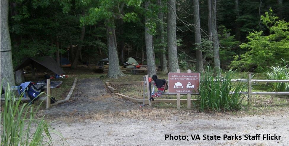
4. Belle Isle State Park: Brewers Point Boat-In Campground
Region: Northern Neck
Water Trail: Mulberry Creek & Rappahannock Long-Distance Trails
Reservations: Required by calling 1-800-933-7275
Campground Location: https://goo.gl/maps/NpN2UeGywvhLuJYf6
The paddle-in campground at Belle Isle State Park offers a great option for beginners. The closest launch point is the park’s ADA-accessible canoe/kayak launch located on Mulberry Creek, less than 1 mile from the 4-site campground. Two sites are close to the water; the other two are a short walk inland. Each site has a fire ring and picnic table. There is no potable water or showers, but a portable toilet is available. If you’re looking for a longer paddling trip into Belle Isle, you can launch at the park’s boat ramp, or nearby Whelan’s Marina, Greenvale Creek, Simonson boat ramp, or Laurel Grove canoe/kayak launch. To see a map of all of the area’s water access points, visit our Northern Neck interactive map.
5. Caledon State Park
Region: Northern Neck
Water Trail: Potomac River Long Distance Trail
Reservations: 1-800-933-7275
Campsite Location: https://goo.gl/maps/PtdatDXeRmADysrd6
Caledon State Park is located right on the Potomac River and is mostly known for its trails and birdwatching opportunities. The park does offer primitive camping, but campsites are only reachable by hiking or paddling to them! There is no potable water available, but the park does provide a portable toilet. Paddling to Caledon State Park should only be attempted by very experienced paddlers as the closest launching point is at Aquia Landing Park which is 12 miles upriver. Downriver, the closest place to launch is at Colonial Beach which is nearly 20 miles from the park.
6. Mockhorn Island
Region: Eastern Shore
Water Trail: Magothy Bay
Reservations: Written authorization required from DWR – click HERE for more info
Suggested Campsite Location: https://goo.gl/maps/4qS1xAWAQquuWnHJ8
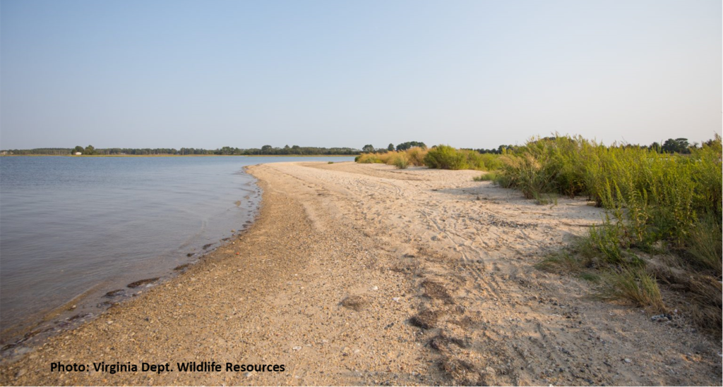
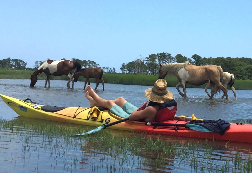
The seaside of Virginia’s Eastern shore is one of the longest stretches of undeveloped and protected coastline on the Atlantic coast. If you’ve been lucky enough to explore some of these islands, you know that the natural beauty can’t quite be put into words. Some of the islands here are open to day-use exploration only, some are completely closed to the public to protect nesting shorebirds, and then there’s Mockhorn Island. Mockhorn is managed by the Virginia Department of Wildlife Resources and primitive camping here is free and permitted with advance authorization. Much of the island is salt marsh, but the west side of the island has sandy beaches which are suitable for camping. The island can be accessed by launching at either Oyster Harbor or Wise Point boat ramps.
Not only does Mockhorn Island allow for world-class birding and wildlife viewing, it also provides visitors with fascinating glimpses into the past. Towards the south end of the island, it’s hard not to notice the concrete ruins of a homestead built by the Cushman family in the 1920s. Further up the island you’ll find fire control towers of WWII, still seemingly keeping watch over the mouth of the Chesapeake Bay. To learn more about Virginia’s barrier islands, please visit exploreourseaside.org.
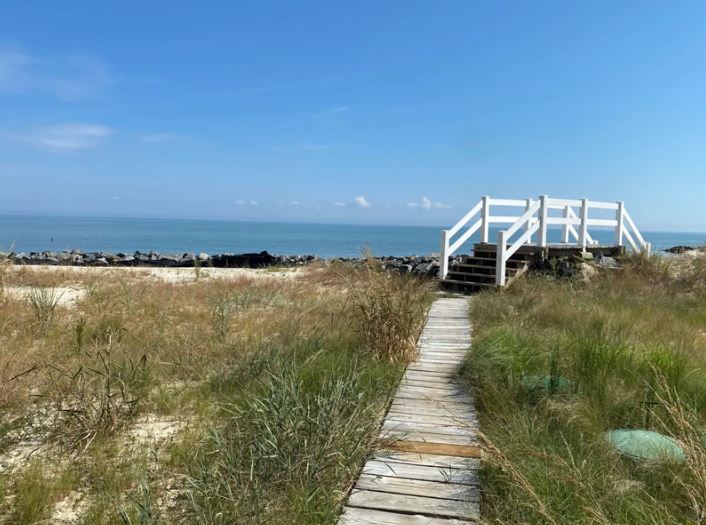
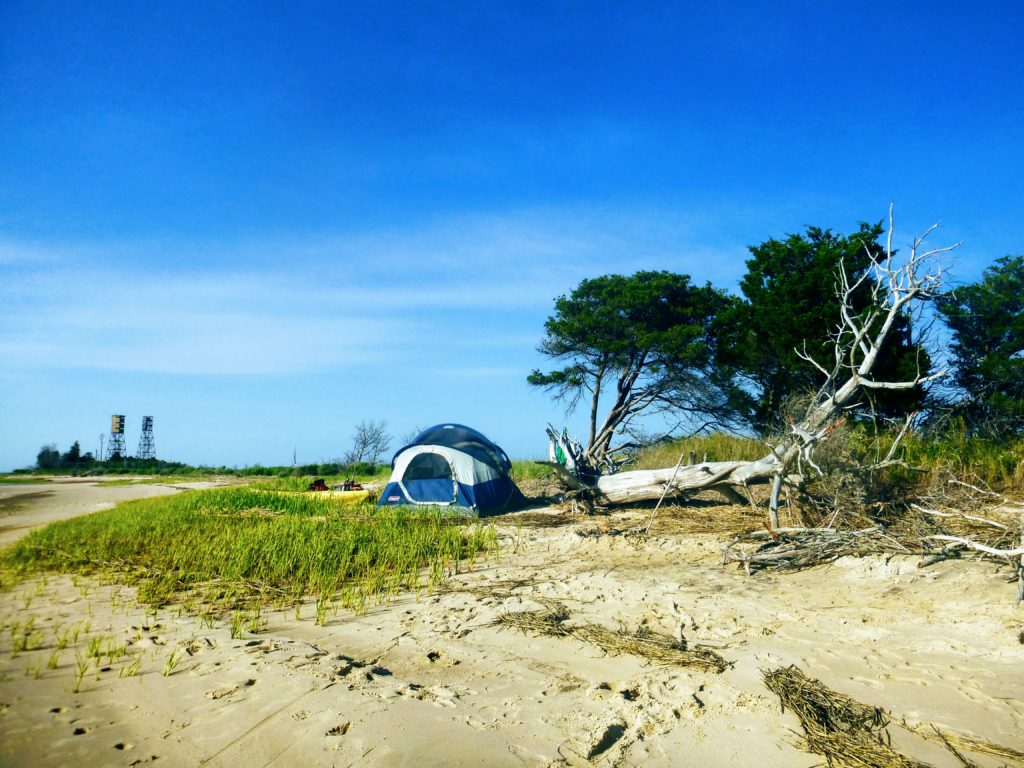
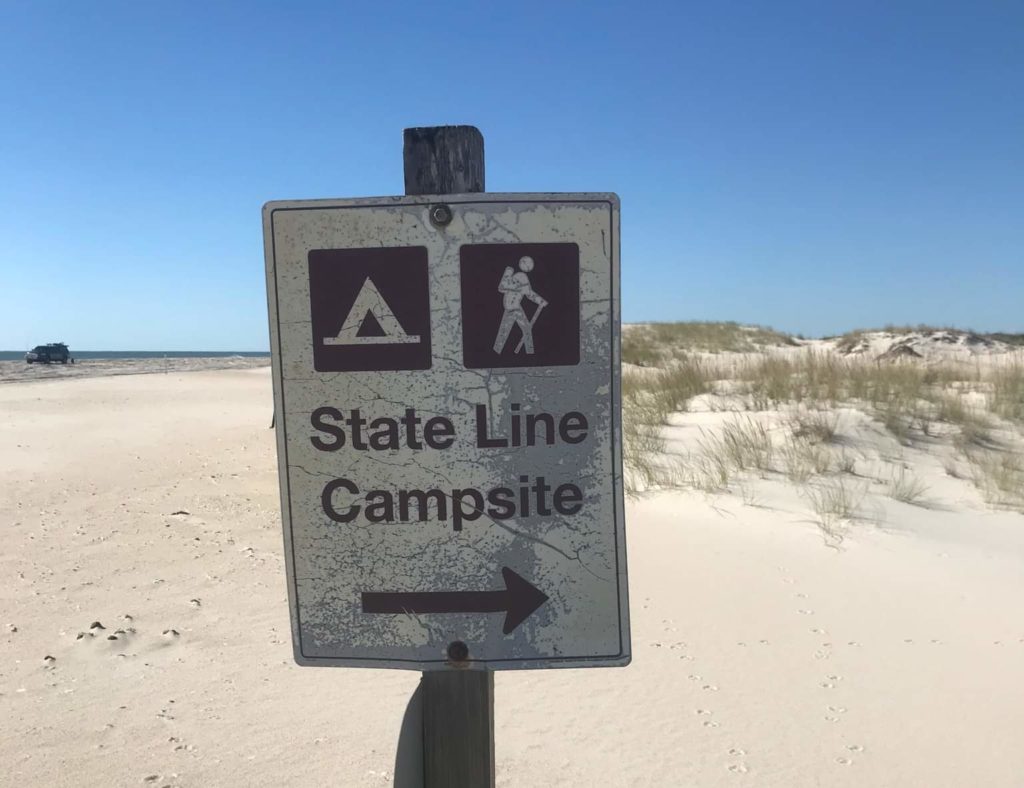
7. Assateague Island: Pope Bay Backcountry Campsite
Region: Eastern Shore
Water Trail: Chincoteague Bay
Reservations: First-come, first served at NPS offices – details HERE
Campsite Location: https://goo.gl/maps/pf5ZSJCdUEwLwUSo6
Okay, yes, this site is technically in Maryland, but it’s only over the state line by 1.7 miles! You CAN paddle to this site from coastal Virginia, so it’s definitely worth mentioning. A backcountry camping permit must be obtained from the Maryland ranger office or the Toms Cove Visitor Center on the day you plan to paddle in, and permits are available on a first-come, first-served basis. You’ll want to launch from either the Greenbackville boat ramp or Chincoteague’s Fir Landing. Each launch is about 9-10 miles from the campsite.
If you’re itching to get out to Assateague but would prefer to go with an experienced guide, Burnham Guides, out of Onancock, offer guided, multi-day trips to Assateague!
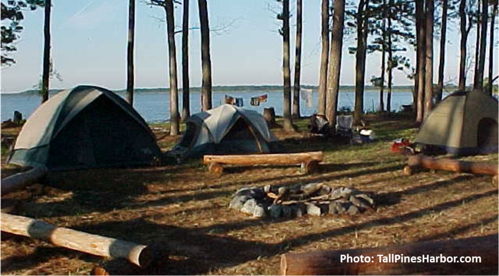
8. Tall Pines Harbor Campground
Region: Eastern Shore
Water Trail: Saxis to Pitts Creek (Pocomoke Sound)
Reservations: Online or by calling (757) 824-0777
Campground Location: https://goo.gl/maps/xx8xUPKU8CuSnnxE9
If you’re interested in exploring the Saxis area and the upper Eastern shore, but prefer some amenities, the Tall Pines Harbor campground might meet your needs. Suggested launching points are located at Pitts Landing (about 3.5 miles way) or Saxis Harbor (about 5.5 miles away). Be sure to book your campsite well in advance to snag one of the tent sites near the beach. This campground is complete with fire rings, picnic tables, a bathhouse, hot showers, a pool, WIFI, and more!
If any of these fabulous camping options sound enticing, be sure to start making plans early, as some of them can fill up far in advance! And as always, if you do venture out to explore Virignia’s water trails, be sure to tag #VirigniaWaterTrails on social media. And if primitive camping isn’t your thing, be sure to check out our post on “paddle-glamping.”
Happy water trails!
About the Author: Laura Scharle lives on the Eastern shore of Maryland and is a frequent paddler in coastal Virginia. She is a Virginia certified ecotour guide and is an independent marketing contractor with a focus in ecotourism and heritage tourism. Laura can be reached through our Eastern Shore ecotour guide listings.